The Policy2Code Prototyping Challenge explored utilizing generative AI technology to translate U.S. government policies for public benefits into plain language and code, culminating in a Demo Day where twelve teams showcased their projects for feedback and evaluation.
This session from FormFest 2024 focused on how to help people get the assistance they need from the U.S. Department of Health and Human Services’ work on the Low Income Home Energy Assistance Program (LIHEAP) and the Maryland Social Services Administration’s work to improve welfare support for kinship caregivers.
This impact report showcases how the city used technology to expand digital equity, modernize services, and responsibly deploy emerging tech to better serve New Yorkers.
New York City Office of Office of Technology and Innovation (OTI)
The City of San José’s Citywide Data Strategy sets a three-year roadmap to unify data practices across departments, strengthen equity and transparency, and leverage data and AI to improve public services
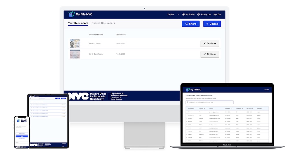
MyFile NYC is a digital platform that allows New York City residents experiencing homelessness to securely store, share, and manage vital documents with the Department of Homeless Services, streamlining the process of establishing eligibility for public benefits. This pilot, launched in 2022, aims to improve service access by reducing barriers like communication and documentation challenges, while allowing users control over their information.
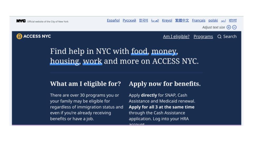
The NYC Mayor’s Office for Economic Opportunity (NYC Opportunity) developed the NYC Benefits Platform, including ACCESS NYC, to help residents easily discover and check eligibility for over 80 social programs.
The Seattle.gov website's new Assistance and Discounts page centralizes information on city benefits and services, offering a user-friendly and consistent experience across 7,000 pages.
The article discusses effective strategies for training government partners in digital services, emphasizing the importance of prioritizing training, setting clear objectives, and fostering mutual understanding and trust.
Recording of GOVChats hosted by GTA's Digital Services Georgia, where speakers dive into the artificial intelligence (AI) programs and initiatives unfolding across the states of Georgia, Maryland, and Vermont.